GIS MAPPING
GIS MAPPING
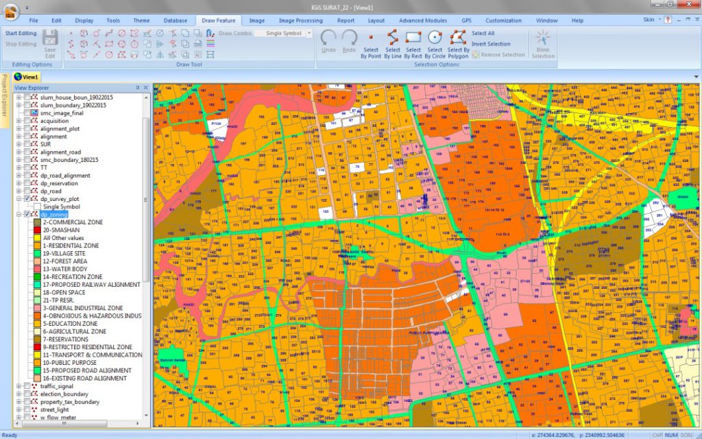
A geographic information system (GIS) map displays data in a visual format. It is essentially a database combined with spatial or geographic information. Plotting information on top of a map can reveal data relationships that would otherwise be difficult to see.